Bay Harbor Islands, Florida facts for kids
Quick facts for kids
Bay Harbor Islands, Florida
|
|
|---|---|
| Town of Bay Harbor Islands | |

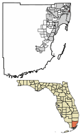
Location in Miami-Dade County, Florida
|
|

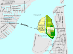
U.S. Census Bureau map showing the Town's boundaries
|
|
| Country | |
| State | |
| County | |
| Incorporated | April 28, 1947 |
| Government | |
| • Type | Council-Manager |
| Area | |
| • Total | 0.42 sq mi (1.09 km2) |
| • Land | 0.40 sq mi (1.03 km2) |
| • Water | 0.03 sq mi (0.06 km2) |
| Elevation | 7 ft (2 m) |
| Population
(2020)
|
|
| • Total | 5,922 |
| • Density | 14,954.55/sq mi (5,768.58/km2) |
| Time zone | UTC-5 (Eastern (EST)) |
| • Summer (DST) | UTC-4 (EDT) |
| ZIP code |
33154
|
| Area code(s) | 305, 786, 645 |
| FIPS code | 12-03975 |
| GNIS feature ID | 0278201 |
Bay Harbor Islands is a town in Miami-Dade County, Florida, United States. The town is part of the Miami metropolitan area of South Florida. It is separated from the mainland by Biscayne Bay. The population was 5,922 at the 2020 US census.
Contents
History
Bay Harbor Islands was founded by Shepard Broad on April 28, 1947.
Geography
Bay Harbor Islands is located at 25°53′15″N 80°8′9″W / 25.88750°N 80.13583°W (25.887522, –80.135739). It sits near the north end of Biscayne Bay and consists of two islands, originally known as Broadview and Bay Harbor, now referred to as, respectively, the West and East Islands. The West Island features single family homes, while the East Island contains the business district, the Ruth K. Broad Bay Harbor K–8 Center, and multi-family housing. To the west, across Biscayne Bay, is the city of North Miami, connected via the Shepard Broad Causeway. To the east, across Indian Creek, lie the village of Bal Harbour and the town of Surfside. To the south across Indian Creek Lake, with no direct road access from Bay Harbor Islands, lies the village of Indian Creek.
Bay Harbor Islands is approximately 15 miles (24 km) (30 minutes driving distance) northeast of Miami International Airport, and 14 miles (23 km) (35 minutes) north of PortMiami.
According to the United States Census Bureau, the town has a total area of 0.4 square miles (1.0 km2), including 0.03 square miles (0.08 km2) (5.94%) of water.
Surrounding areas
- Biscayne Bay
- Biscayne Bay


 Bal Harbour
 - Biscayne Bay

 Bal Harbour
 - Biscayne Bay


 Surfside
 - Indian Creek, Surfside
East Island architecture
At one time, Bay Harbor Islands East Island featured one of the largest concentrated collections of mid-century Miami Modern architecture. Now, one will find many of these buildings intermixed with contemporary residences and boutique waterfront condominiums.
Demographics
| Historical population | |||
|---|---|---|---|
| Census | Pop. | %± | |
| 1950 | 296 | — | |
| 1960 | 3,249 | 997.6% | |
| 1970 | 4,619 | 42.2% | |
| 1980 | 4,869 | 5.4% | |
| 1990 | 4,703 | −3.4% | |
| 2000 | 5,146 | 9.4% | |
| 2010 | 5,628 | 9.4% | |
| 2020 | 5,922 | 5.2% | |
| U.S. Decennial Census | |||
2020 census
| Race | Number | Percentage |
|---|---|---|
| White (NH) | 2,748 | 46.40% |
| Black or African American (NH) | 111 | 1.87% |
| Native American or Alaska Native (NH) | 0 | 0.00% |
| Asian (NH) | 67 | 1.13% |
| Pacific Islander or Native Hawaiian (NH) | 0 | 0.00% |
| Some other race (NH) | 53 | 0.89% |
| Two or more races/Multiracial (NH) | 206 | 3.48% |
| Hispanic or Latino | 2,737 | 46.22% |
| Total | 5,922 |
As of the 2020 United States census, there were 5,922 people, 2,139 households, and 1,555 families residing in the town.
2010 census
| Bay Harbor Islands Demographics | |||
|---|---|---|---|
| 2010 Census | Bay Harbor Islands | Miami-Dade County | Florida |
| Total population | 5,628 | 2,496,435 | 18,801,310 |
| Population, percent change, 2000 to 2010 | +9.4% | +10.8% | +17.6% |
| Population density | 14,221.7/sq mi | 1,315.5/sq mi | 350.6/sq mi |
| White or Caucasian (including White Hispanic) | 91.5% | 73.8% | 75.0% |
| (Non-Hispanic White or Caucasian) | 49.1% | 15.4% | 57.9% |
| Black or African-American | 2.5% | 18.9% | 16.0% |
| Hispanic or Latino (of any race) | 46.3% | 65.0% | 22.5% |
| Asian | 1.2% | 1.5% | 2.4% |
| Native American or Native Alaskan | 0.2% | 0.2% | 0.4% |
| Pacific Islander or Native Hawaiian | 0.0% | 0.0% | 0.1% |
| Two or more races (Multiracial) | 2.3% | 2.4% | 2.5% |
| Some Other Race | 2.3% | 3.2% | 3.6% |
As of the 2010 United States census, there were 5,628 people, 2,494 households, and 1,418 families residing in the town.
Education
Ruth K. Broad Bay Harbor K–8 Center in Bay Harbor Islands serves as the local elementary and K–8 school. Residents who want to have a conventional middle school may instead choose the zoned middle school, Miami Beach Nautilus Middle School. Miami Beach Senior High School is the senior high school serving this area.
Notable people
- Christian Fittipaldi (born 1971), race car driver
- George Kenney (1889–1977). United States Army general during World War II who commanded Allied Air Forces in the Southwest Pacific Area from August 1942 and 1945
- Nito Mestre (born 1952), songwriter
- Louis Slobodkin (1903–1975), sculptor, writer and illustrator of numerous children's books
- Sebastian Spreng (born 1956), visual artist and music journalist
- Walter Stone (1920–1999), screenwriter best known for his work as the head writer for The Honeymooners
- Néstor Torres (born 1957), jazz flautist
- Lesley Visser (born 1953), sportscaster who was the first female NFL analyst on TV
- Garrett Wittels (born 1990), baseball player
See also
 In Spanish: Bay Harbor Islands para niños

