Barnes Ice Cap facts for kids
Quick facts for kids Barnes Ice Cap |
|
|---|---|
| Type | Ice cap |
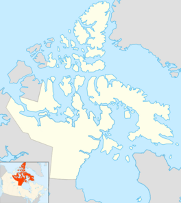
| Location | Baffin Island |
| Coordinates | 70°00′N 73°30′W / 70.000°N 73.500°W |
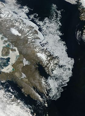
The Barnes Ice Cap is an ice cap located in central Baffin Island, Nunavut, Canada.
Geography
It covers close to 6,000 km2 (2,300 sq mi) in the area of the Baffin Mountains. It has been thinning due to regional warming. Between 2004 and 2006, the ice cap was thinning at a rate of 1 m (3 ft 3 in) per year.
The ice cap contains Canada's oldest ice, some of it being over 20,000 years old. It is a remnant of the Laurentide Ice Sheet, which covered much of Canada during the last glacial period of the Earth's current ice age. Generator Lake is located at the southeastern end of the ice cap.

All content from Kiddle encyclopedia articles (including the article images and facts) can be freely used under Attribution-ShareAlike license, unless stated otherwise. Cite this article:
Barnes Ice Cap Facts for Kids. Kiddle Encyclopedia.


