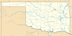
Balko, Oklahoma facts for kids
Quick facts for kids
Balko, Oklahoma
|
|
|---|---|
| Country | United States |
| State | Oklahoma |
| County | Beaver |
| Population
(2000)
|
|
| • Total | 623 |
| Time zone | UTC-6 (Central (CST)) |
| • Summer (DST) | UTC-5 (CDT) |
| ZIP codes |
73931
|
Balko is an unincorporated community in Beaver County, Oklahoma, United States. The population in 2020 was 473.
History
The post office was established March 14, 1904.
Balko has a school, gas station, diner, tire shop, three churches and post office. The local economy is dependent on farming, ranching, and the oil industry. The local school is a K-12 public school.
Geography
Balko is located in the Oklahoma Panhandle, along U.S. Route 412, east of U.S. Route 83 and west of U.S. Route 270.
The nearest airport is Beaver Municipal, about 21 miles northeast. The nearest commercial airport is Liberal Mid-America Regional in Kansas, about 42 miles north-northwest.
Climate
| Climate data for Balko, Oklahoma | |||||||||||||
|---|---|---|---|---|---|---|---|---|---|---|---|---|---|
| Month | Jan | Feb | Mar | Apr | May | Jun | Jul | Aug | Sep | Oct | Nov | Dec | Year |
| Mean daily maximum °F (°C) | 46.7 (8.2) |
51 (11) |
59.5 (15.3) |
70.6 (21.4) |
78.1 (25.6) |
87.4 (30.8) |
93.5 (34.2) |
91.4 (33.0) |
82.9 (28.3) |
73 (23) |
58.7 (14.8) |
48.3 (9.1) |
70.1 (21.2) |
| Mean daily minimum °F (°C) | 17.4 (−8.1) |
23 (−5) |
30.6 (−0.8) |
40.5 (4.7) |
50.6 (10.3) |
59.5 (15.3) |
65.4 (18.6) |
63.6 (17.6) |
55.7 (13.2) |
43 (6) |
31.1 (−0.5) |
20.5 (−6.4) |
41.7 (5.4) |
| Average precipitation inches (mm) | 0.4 (10) |
0.7 (18) |
1.3 (33) |
1.3 (33) |
3.3 (84) |
3.3 (84) |
2.4 (61) |
2.4 (61) |
1.8 (46) |
1.1 (28) |
1.1 (28) |
0.5 (13) |
19.5 (500) |
| Source: Weatherbase.com | |||||||||||||

All content from Kiddle encyclopedia articles (including the article images and facts) can be freely used under Attribution-ShareAlike license, unless stated otherwise. Cite this article:
Balko, Oklahoma Facts for Kids. Kiddle Encyclopedia.


