Baldwin, Georgia facts for kids
Quick facts for kids
Baldwin, Georgia
City of Baldwin
|
||
|---|---|---|

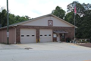
Baldwin City Hall
|
||
|
||
| Motto(s):
"The Hub of Development in Northeast Georgia"
|
||

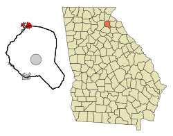
Location in Banks County and the state of Georgia
|
||
| Country | United States | |
| State | Georgia | |
| Counties | Habersham, Banks | |
| Area | ||
| • Total | 5.04 sq mi (13.05 km2) | |
| • Land | 5.03 sq mi (13.02 km2) | |
| • Water | 0.01 sq mi (0.03 km2) | |
| Elevation | 1,490 ft (450 m) | |
| Population
(2020)
|
||
| • Total | 3,629 | |
| • Density | 721.76/sq mi (278.68/km2) | |
| Time zone | UTC-5 (Eastern (EST)) | |
| • Summer (DST) | UTC-4 (EDT) | |
| ZIP code |
30511
|
|
| Area code(s) | 706 | |
| FIPS code | 13-04980 | |
| GNIS feature ID | 2403149 | |
Baldwin is a city in Banks and Habersham counties in the U.S. state of Georgia. As of the 2010 census, the city had a population of 3,279, up from 2,425 at the 2000 census.
Baldwin is located on U.S. Route 441 just south of Georgia State Route 365. Baldwin sits astride the Eastern Continental Divide, which separates waters flowing southeastward toward the Savannah River and the Atlantic Ocean from waters flowing southwestward toward the Chattahoochee River and the Gulf of Mexico. City Hall sits in Habersham County. Baldwin borders the slightly larger city of Cornelia, which houses the Habersham Chamber of Commerce. Nearby in Demorest is Piedmont University. Also nearby is Lake Russell, a recreation area in Chattahoochee National Forest. The Habersham County airport is in Baldwin. The largest employer is Fieldale Corporation, a chicken processing company.
Contents
Geography
Baldwin is located in northeastern Georgia and is split between Banks and Habersham County. It is located along two major arterial routes: U.S. Highway 441 and U.S. Highway 23/Georgia State Highway 365, both of which are divided four-lane highways. Highway 23/365 becomes Interstate 985 in Gainesville, 17 miles (27 km) southwest of the Baldwin limits.
According to the United States Census Bureau, the city has a total area of 4.9 square miles (12.7 km2), all land.
Baldwin is home to the Habersham County Airport, located on the north side of town. The airport offers a 5,500-foot (1,700 m) paved runway at 1,447 feet (441 m) above sea level. It serves as the gateway airport to the Georgia mountains with its central location in the foothills of the Blue Ridge Mountains.
Demographics
| Historical population | |||
|---|---|---|---|
| Census | Pop. | %± | |
| 1900 | 130 | — | |
| 1910 | 280 | 115.4% | |
| 1920 | 193 | −31.1% | |
| 1930 | 319 | 65.3% | |
| 1940 | 402 | 26.0% | |
| 1950 | 490 | 21.9% | |
| 1960 | 698 | 42.4% | |
| 1970 | 772 | 10.6% | |
| 1980 | 1,080 | 39.9% | |
| 1990 | 1,439 | 33.2% | |
| 2000 | 2,425 | 68.5% | |
| 2010 | 3,279 | 35.2% | |
| 2020 | 3,629 | 10.7% | |
| U.S. Decennial Census | |||
2020 census
| Race | Num. | Perc. |
|---|---|---|
| White | 1,836 | 50.59% |
| Black or African American | 136 | 3.75% |
| Native American | 3 | 0.08% |
| Asian | 78 | 2.15% |
| Other/Mixed | 79 | 2.18% |
| Hispanic or Latino | 1,497 | 41.25% |
As of the 2020 United States Census, there were 3,629 people, 984 households, and 772 families residing in the city.
In 2020 the Baldwin population by county breakdown was as follows: 2,538 in Habersham County and 741 in Banks County.
2010 census
According to the 2010 census, the population of Baldwin was 3,279, representing a population growth in the previous decade of 35.2%.
History
Baldwin was incorporated by an act of the Georgia General Assembly on December 17, 1896. The city was named in honor of Joseph A. Baldwin, a railroad official.
Education
The portion in Habersham County is in the Habersham County School District.
The portion in Banks County is in the Banks County School District. Students there are zoned to Banks County High School.
Notable people
- Buck Simmons (1946–2012), Dirt Super Late Model Legend and NASCAR Winston Cup Series driver
Nearby institutions
The closest hospital is Habersham County Medical Center in Demorest. Stephens County Hospital is to the northeast in Toccoa, and Northeast Georgia Medical Center is to the southwest in Gainesville.
Colleges and universities in the region include:
- University of Georgia (Athens, GA), 41 miles to the south
- University of North Georgia (Gainesville, 28 miles southwest, & Dahlonega, 32 miles west)
- Brenau University (Gainesville, 22 miles southwest)
- Athens Technical College (Athens, 41 miles south)
- Georgia Gwinnett College (Gwinnett, 51 miles southwest)
- Piedmont University (Demorest, 6 miles north)
- North Georgia Technical College (Clarkesville, 12 miles north)
Comprehensive plan update
In 2007, the city of Baldwin began efforts to develop its Comprehensive Plan Update. This document provides three key planning elements: a Community Assessment with supporting data, a Community Participation Plan and a Community Agenda. The Assessment provides an overview of current conditions in the city and identifies key challenges being faced by our community.
The Community Participation Plan establishes a process for ensuring active public participation and involvement in developing a community vision, setting goals for the future and establishing the community's agenda for the next decade. Finally, the Community Agenda serves as the city's action plan for carrying out this new vision, achieving the goals and objectives as defined in the plan and it serves as a tool for measuring our success during the implementation phase.
See also
 In Spanish: Baldwin (Georgia) para niños


