Aurora County, South Dakota facts for kids
Quick facts for kids
Aurora County
|
|
|---|---|

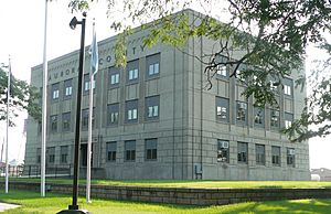
Aurora County courthouse in Plankinton
|
|

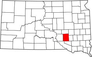
Location within the U.S. state of South Dakota
|
|
 South Dakota's location within the U.S. |
|
| Country | |
| State | |
| Founded | 1879 (created) 1881 (organized) |
| Named for | Aurora, a Roman goddess |
| Seat | Plankinton |
| Largest city | Plankinton |
| Area | |
| • Total | 713 sq mi (1,850 km2) |
| • Land | 708 sq mi (1,830 km2) |
| • Water | 4.3 sq mi (11 km2) 0.6% |
| Population
(2020)
|
|
| • Total | 2,747 |
| • Estimate
(2023)
|
2,782 |
| • Density | 3.853/sq mi (1.4875/km2) |
| Time zone | UTC−6 (Central) |
| • Summer (DST) | UTC−5 (CDT) |
| Congressional district | At-large |
Aurora County is a county in the U.S. state of South Dakota. As of the 2020 census, the population was 2,747. The county was created in 1879, and was organized in 1881.
Contents
History
Aurora County, named for Aurora, the Roman goddess of the dawn, was created by the Dakota Territory on October 1, 1879. It was organized on August 29, 1881, when three county commissioners were appointed. The county had been established from the combination of former counties Cragin and Wetmore, which had both been formed in 1873. The three county commissioners met on August 29, 1881, and named Plankinton the county seat, an act which was ratified by voters in November 1882. The northern portion of Aurora County was partitioned off on April 17, 1883, and established as Jerauld County.
Geography
The terrain of Aurora County consists of low rolling hills, partially devoted to agriculture. It is dotted with small lakes and ponds. The highest point is the upper west boundary line, and the terrain slopes east-northeastward; the lowest point is the county's northeast corner at 1,325 ft (404 m) ASL.
The county has a total area of 713 square miles (1,850 km2), of which 708 square miles (1,830 km2) is land and 4.3 square miles (11 km2) (0.6%) is water.
Major highways
Adjacent counties
- Jerauld County - north
- Sanborn County - northeast
- Davison County - east
- Douglas County - south
- Charles Mix County - southwest
- Brule County - west
Protected areas
- Crystal Lake Public Shooting Area
- Hanson Lake State Public Shooting Area
- Kimball State Public Shooting Area
- Koch Waterfowl Production Area
- Kramer Slaugh Public Shooting Area
- Krell Waterfowl Production Area
- Lutz Waterfowl Production Area
- Maine Waterfowl Production Area
- National Waterfowl Production Area
- Pleasant Lake State Public Shooting Area
- Schute Waterfowl Production Area
- Sorenson Waterfowl Production Area
- Wilmarth Lake Game Production Area
Demographics
| Historical population | |||
|---|---|---|---|
| Census | Pop. | %± | |
| 1880 | 69 | — | |
| 1890 | 5,045 | 7,211.6% | |
| 1900 | 4,011 | −20.5% | |
| 1910 | 6,143 | 53.2% | |
| 1920 | 7,246 | 18.0% | |
| 1930 | 7,139 | −1.5% | |
| 1940 | 5,387 | −24.5% | |
| 1950 | 5,020 | −6.8% | |
| 1960 | 4,749 | −5.4% | |
| 1970 | 4,183 | −11.9% | |
| 1980 | 3,628 | −13.3% | |
| 1990 | 3,136 | −13.6% | |
| 2000 | 3,058 | −2.5% | |
| 2010 | 2,710 | −11.4% | |
| 2020 | 2,747 | 1.4% | |
| 2023 (est.) | 2,782 | 2.7% | |
| U.S. Decennial Census 1790-1960 1900-1990 1990-2000 2010-2020 |
|||
2020 census
As of the 2020 census, there were 2,747 people, 1,096 households, and 746 families residing in the county. The population density was 3.9 inhabitants per square mile (1.5/km2). There were 1,260 housing units.
2010 census
As of the 2010 census, there were 2,710 people, 1,102 households, and 736 families residing in the county. The population density was 3.8 inhabitants per square mile (1.5/km2). There were 1,324 housing units at an average density of 1.9 per square mile (0.73/km2). The racial makeup of the county was 95.1% white, 1.5% American Indian, 0.7% Asian, 0.4% black or African American, 1.8% from other races, and 0.5% from two or more races. Those of Hispanic or Latino origin made up 3.7% of the population. In terms of ancestry, 54.3% were German, 13.7% were Dutch, 11.8% were Norwegian, 8.7% were Irish, 7.2% were English, and 4.9% were American.
Of the 1,102 households, 28.3% had children under the age of 18 living with them, 57.5% were married couples living together, 5.4% had a female householder with no husband present, 33.2% were non-families, and 29.9% of all households were made up of individuals. The average household size was 2.37 and the average family size was 2.96. The median age was 43.2 years.
The median income for a household in the county was $45,230 and the median income for a family was $55,588. Males had a median income of $30,185 versus $27,206 for females. The per capita income for the county was $21,291. About 4.5% of families and 8.2% of the population were below the poverty line, including 7.4% of those under age 18 and 12.8% of those age 65 or over.
Communities
Cities
- Plankinton (county seat)
- White Lake
Town
Census-designated places
Townships
- Aurora Township
- Belford Township
- Bristol Township
- Center Township
- Cooper Township
- Crystal Lake Township
- Dudley Township
- Eureka Township
- Firesteel Township
- Gales Township
- Hopper Township
- Lake Township
- Palatine Township
- Patten Township
- Plankinton Township
- Pleasant Lake Township
- Pleasant Valley Township
- Truro Township
- Washington Township
- White Lake Township
See also
 In Spanish: Condado de Aurora para niños

