Arlington Peak (California) facts for kids
Quick facts for kids Arlington Peak |
|
|---|---|

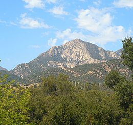
Easterly view of Arlington Peak from Skofield Park in Santa Barbara.
|
|
| Highest point | |
| Elevation | 3,258 ft (993 m) |
| Prominence | 75 ft (23 m) |
| Geography | |
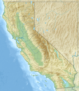
| Location | Santa Barbara County, California, U.S. |
| Parent range | Santa Ynez Mountains |
| Topo map | USGS Santa Barbara |
| Climbing | |
| Easiest route | Trail |
Arlington Peak is a 3,258-foot (993 m) high peak within the Santa Ynez Mountains located north of Santa Barbara, California. The peak is adjacent to the south of La Cumbre Peak and to the southeast of Cathedral Peak.
The name of the peak purportedly originated in 1889 from the staff of the Arlington Hotel who referred to the area comprising the three peaks as The Arlington Crags.
The peak is accessible via a 4.1-mile (7 km) "out and back" trail used for hiking and rock climbing, which is rated as difficult.
Geology
Arlington Peak is primarily composed of Matilija Sandstone

All content from Kiddle encyclopedia articles (including the article images and facts) can be freely used under Attribution-ShareAlike license, unless stated otherwise. Cite this article:
Arlington Peak (California) Facts for Kids. Kiddle Encyclopedia.


