Argyle, Iowa facts for kids
Quick facts for kids
Argyle, Iowa
|
|
|---|---|
 |
|
| Country | United States |
| State | Iowa |
| County | Lee |
| Area | |
| • Total | 0.60 sq mi (1.56 km2) |
| • Land | 0.60 sq mi (1.56 km2) |
| • Water | 0.00 sq mi (0.00 km2) |
| Elevation | 679 ft (207 m) |
| Population
(2020)
|
|
| • Total | 91 |
| • Density | 150.91/sq mi (58.23/km2) |
| Time zone | UTC-6 (Central (CST)) |
| • Summer (DST) | UTC-5 (CDT) |
| ZIP codes |
52619
|
| Area code(s) | 319 |
| FIPS code | 19-02710 |
| GNIS feature ID | 454227 |
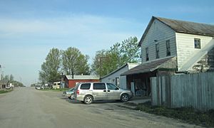
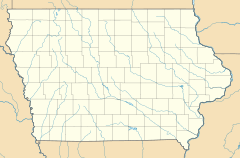
Argyle is an unincorporated community in southwestern Lee County, Iowa, United States. As of the 2020 census, its population was 91.
It lies along the concurrent Iowa Highways 27 and 394 southwest of the city of Fort Madison, the county seat of Lee County. Its elevation is 679 feet (207 m). Although Argyle is unincorporated, it has a post office, with the ZIP code of 52619, which opened on 15 March 1885. The community is part of the Fort Madison–Keokuk, IA-MO Micropolitan Statistical Area.
The Central Lee Community School District serves the community.
Demographics
| Historical population | |||
|---|---|---|---|
| Census | Pop. | %± | |
| 2020 | 91 | — | |
| U.S. Decennial Census | |||
Transportation
Amtrak’s Southwest Chief, which operates between Los Angeles and Chicago, passes through the town on BNSF tracks, but makes no stop. The nearest station is located in Fort Madison, 19 miles (31 km) to the east.


