Argençola facts for kids
Quick facts for kids
Argençola
|
||
|---|---|---|
|
Municipality
|
||
 |
||
|
||
| Country | ||
| Community | ||
| Province | Barcelona | |
| Comarca | Anoia | |
| Area | ||
| • Total | 47.1 km2 (18.2 sq mi) | |
| Elevation | 716 m (2,349 ft) | |
| Population
(2018)
|
||
| • Total | 219 | |
| • Density | 4.650/km2 (12.04/sq mi) | |
| Demonyms | Argençolenc, argençolenca | |
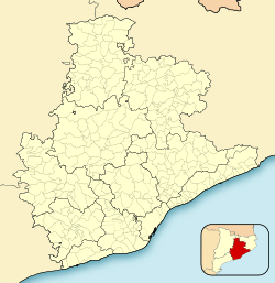
Argençola (Catalan pronunciation: [əɾʒənˈsɔlə]) is a municipality in the comarca of the Anoia in Catalonia, Spain. It is situated in the east of the comarca, bordering the Segarra and the Conca de Barberà. The Anoia river has its source on the territory of the municipality. A local road links the municipality with the main N-II road from Barcelona to Lleida.
Demography
| 1900 | 1930 | 1950 | 1970 | 1986 | 2007 |
|---|---|---|---|---|---|
| 510 | 658 | 622 | 239 | 192 | 229 |
Subdivisions
The municipality of Argençola includes six outlying villages. Populations are given as of 2001:
- Carbasi (30), to the north-east of Argençola at an elevation of 775 m
- Clariana (36), to the east of Argençola, with ruins of Clariana castle
- Contrast (18), to the south-east of Argençola
- Els Plans de Ferran (7)
- Porquerisses i Aberells (41), to the north of Argençola
- Rocamora (8), to the west of Argençola
See also
 In Spanish: Argensola para niños

All content from Kiddle encyclopedia articles (including the article images and facts) can be freely used under Attribution-ShareAlike license, unless stated otherwise. Cite this article:
Argençola Facts for Kids. Kiddle Encyclopedia.


