Archuleta County, Colorado facts for kids
Quick facts for kids
Archuleta County
|
|
|---|---|

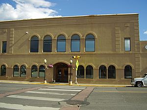
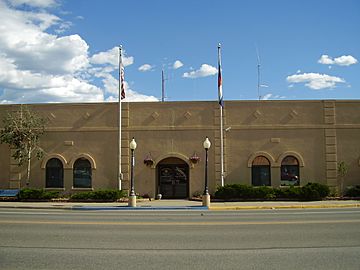
Archuleta County Courthouse
|
|

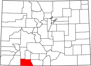
Location within the U.S. state of Colorado
|
|
 Colorado's location within the U.S. |
|
| Country | |
| State | |
| Founded | April 14, 1885 |
| Named for | Antonio D. Archuleta |
| Seat | Pagosa Springs |
| Largest town | Pagosa Springs |
| Area | |
| • Total | 1,356 sq mi (3,510 km2) |
| • Land | 1,350 sq mi (3,500 km2) |
| • Water | 5.3 sq mi (14 km2) 0.4% |
| Population
(2020)
|
|
| • Total | 13,359 |
| • Density | 9.9/sq mi (3.8/km2) |
| Time zone | UTC−7 (Mountain) |
| • Summer (DST) | UTC−6 (MDT) |
| Congressional district | 3rd |
Archuleta County is a county located in the U.S. state of Colorado. As of the 2020 census, the population was 13,359. The county seat and the only incorporated municipality in the county is Pagosa Springs.
Contents
History
Archuleta County was created by the Colorado legislature on April 14, 1885, out of western Conejos County. It was named for Jose Manuel Archuleta, "head of one of the old Spanish families of New Mexico", and in honor of his son Antonio D. Archuleta, who was the Senator from Conejos County at the time.
Geography
According to the U.S. Census Bureau, the county has a total area of 1,356 square miles (3,510 km2), of which 1,350 square miles (3,500 km2) is land and 5.3 square miles (14 km2) (0.4%) is water.
Adjacent counties
- Mineral County, Colorado - north
- Rio Grande County, Colorado - northeast
- Conejos County, Colorado - east
- Rio Arriba County, New Mexico - south
- San Juan County, New Mexico - southwest
- La Plata County, Colorado - west
- Hinsdale County, Colorado - northwest
Airport
- Stevens Field
Major highways
National protected areas
- Rio Grande National Forest
- San Juan National Forest
- Chimney Rock National Monument
- South San Juan Wilderness
| Historical population | |||
|---|---|---|---|
| Census | Pop. | %± | |
| 1890 | 826 | — | |
| 1900 | 2,117 | 156.3% | |
| 1910 | 3,302 | 56.0% | |
| 1920 | 3,590 | 8.7% | |
| 1930 | 3,204 | −10.8% | |
| 1940 | 3,806 | 18.8% | |
| 1950 | 3,030 | −20.4% | |
| 1960 | 2,629 | −13.2% | |
| 1970 | 2,733 | 4.0% | |
| 1980 | 3,664 | 34.1% | |
| 1990 | 5,345 | 45.9% | |
| 2000 | 9,898 | 85.2% | |
| 2010 | 12,084 | 22.1% | |
| 2020 | 13,359 | 10.6% | |
| 2023 (est.) | 14,189 | 17.4% | |
| U.S. Decennial Census 1790-1960 1900-1990 1990-2000 |
|||
State protected area
Scenic and historic trails
- Continental Divide National Scenic Trail
- Old Spanish National Historic Trail
Waterways
- Chamita River
- Dutton Creek
- Little Navajo River
- Martinez Creek
- McCabe Creek
- Mill Creek
- Piedra River
- Rio Blanco
- Rio Chama
- San Juan River
- Stollsteimer Creek
- Williams Creek
Demographics
According to the 2020 census, there were 13,359 people, 5,736 households living in the county. The average household size was 2.34 persons. The population density was 9.9 people per square mile (3.8 people/km2). As of 2021, there were 9,693 housing units at an average density of 7.2 per square mile (2.8/km2). The racial makeup of the county was 90.9% White, 0.9% Black or African American, 3.8% Native American, 1.2% Asian, 0.2% Pacific Islander, and 3.1% from two or more races. 18.5% of the population were Hispanic or Latino of any race.
The age distribution was 4.1% under 5 years, 17.5% under 18 years, 51.1% between 18 and 64 years, and 27.3% 65 years or older. 49.9% were female.
The median household income (in 2020 dollars) was $55,658. The per capita income for the county was $32,995. About 9.40% of the population were at or below the poverty line.
Communities
Town
Census-designated place
Other unincorporated places
- Chimney Rock
- Chromo
- Juanita
- Dyke
Education
School districts include:
- Archuleta County School District 50-JT
- Bayfield School District 10 JT-R
- Ignacio School District 11-JT
See also
 In Spanish: Condado de Archuleta para niños


