Arapaho Glacier facts for kids
Quick facts for kids Arapaho Glacier |
|
|---|---|
 |
|
| Type | Mountain glacier |
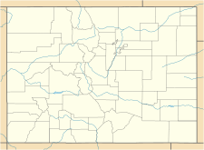
| Location | Boulder County, Colorado, United States |
| Coordinates | 40°01′24″N 105°38′52″W / 40.02333°N 105.64778°W |
| Area | 39 acres (16 ha) |
| Length | .25 mi (0.40 km) long and .50 mi (0.80 km) wide |
| Thickness | 15 ft (4.6 m) |
| Terminus | Talus/proglacial lake |
| Status | Retreating |
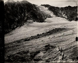
Arapaho Glacier is an alpine glacier in a cirque immediately southeast of North Arapaho Peak, in Roosevelt National Forest in the U.S. state of Colorado. The glacier is just east of the Continental Divide. Arapaho Glacier is the largest glacier in the state of Colorado and helps provide water for the city of Boulder, Colorado. The glacier has a negative glacier mass balance and lost over 52% of its surface area during the 20th Century.
See also
 In Spanish: Glaciar Arapaho para niños

All content from Kiddle encyclopedia articles (including the article images and facts) can be freely used under Attribution-ShareAlike license, unless stated otherwise. Cite this article:
Arapaho Glacier Facts for Kids. Kiddle Encyclopedia.
