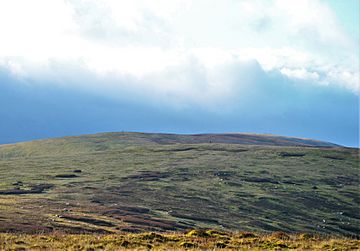
Andrewhinney Hill facts for kids
Quick facts for kids Andrewhinney Hill |
|
|---|---|
 |
|
| Highest point | |
| Elevation | 677.3 m (2,222 ft) |
| Prominence | 194 m (636 ft) |
| Listing | Ma,Hu,Tu,Sim, G, D,DN,Y |
| Geography | |
| Location | Dumfries and Galloway, Scottish Borders, Scotland |
| Parent range | Ettrick Hills, Southern Uplands |
| OS grid | NT 19760 13873 |
| Topo map | OS Landranger 79 |
Andrewhinney Hill is a hill in the Ettrick Hills range, part of the Southern Uplands of Scotland. It is the highest summit of a ridge that runs parallel to the A708 road on its southern side, with the Grey Mare's Tail in the Moffat Hills directly opposite. The northwestern slopes are designated as part of the 'Moffat Hills' SSSI and SAC.
Subsidiary SMC Summits
| Summit | Height (m) | Listing |
|---|---|---|
| Trowgrain Middle | 728 | DT,sSim |

All content from Kiddle encyclopedia articles (including the article images and facts) can be freely used under Attribution-ShareAlike license, unless stated otherwise. Cite this article:
Andrewhinney Hill Facts for Kids. Kiddle Encyclopedia.
