Anderson, Missouri facts for kids
Quick facts for kids
Anderson, Missouri
|
|
|---|---|

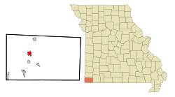
Location in McDonald County and the state of Missouri
|
|
| Country | United States |
| State | Missouri |
| County | McDonald |
| Area | |
| • Total | 2.27 sq mi (5.89 km2) |
| • Land | 2.27 sq mi (5.89 km2) |
| • Water | 0.00 sq mi (0.00 km2) |
| Elevation | 892 ft (272 m) |
| Population
(2020)
|
|
| • Total | 1,981 |
| • Density | 871.54/sq mi (336.49/km2) |
| Time zone | UTC-6 (Central (CST)) |
| • Summer (DST) | UTC-5 (CDT) |
| ZIP code |
64831
|
| Area code(s) | 417 |
| FIPS code | 29-01198 |
| GNIS feature ID | 2393953 |
Anderson is a city in McDonald County, Missouri, United States. The population was 1,981 at the 2020 census.
History
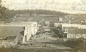
A post office called Anderson has been in operation since 1886. The community has the name of Robert Anderson, a local merchant.
Geography
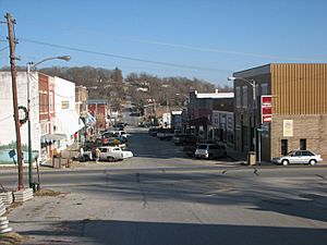
Anderson is in west-central McDonald County on Indian Creek at the intersection of Missouri Routes 59 and 76 and U.S. Route 71. Interstate 49 passes just to the east of the city, with access from Exit 10 (MO 76). Neosho is 16 miles (26 km) to the north, and Bentonville, Arkansas, is 26 miles (42 km) to the southeast. Pineville, the McDonald county seat, is 6 miles (10 km) to the south.
According to the U.S. Census Bureau, Anderson has a total area of 2.27 square miles (5.88 km2), all land. Indian Creek, which forms part of the southern boundary of the city, flows generally southward to join the Elk River, which in turn flows west to the Neosho River in Oklahoma.
Demographics
| Historical population | |||
|---|---|---|---|
| Census | Pop. | %± | |
| 1910 | 721 | — | |
| 1920 | 918 | 27.3% | |
| 1930 | 857 | −6.6% | |
| 1940 | 938 | 9.5% | |
| 1950 | 1,073 | 14.4% | |
| 1960 | 992 | −7.5% | |
| 1970 | 1,065 | 7.4% | |
| 1980 | 1,237 | 16.2% | |
| 1990 | 1,432 | 15.8% | |
| 2000 | 1,856 | 29.6% | |
| 2010 | 1,961 | 5.7% | |
| 2020 | 1,981 | 1.0% | |
| U.S. Decennial Census | |||
2010 census
As of the census of 2010, there were 1,961 people, 715 households, and 486 families living in the city. The population density was 951.9 inhabitants per square mile (367.5/km2). There were 843 housing units at an average density of 409.2 per square mile (158.0/km2). The racial makeup of the city was 85.8% White, 0.4% African American, 4.8% Native American, 0.6% Asian, 0.5% Pacific Islander, 4.9% from other races, and 2.9% from two or more races. Hispanic or Latino of any race were 9.7% of the population.
There were 715 households, of which 39.6% had children under the age of 18 living with them, 46.2% were married couples living together, 15.7% had a female householder with no husband present, 6.2% had a male householder with no wife present, and 32.0% were non-families. 27.7% of all households were made up of individuals, and 10.4% had someone living alone who was 65 years of age or older. The average household size was 2.62 and the average family size was 3.17.
The median age in the city was 34.3 years. 27% of residents were under the age of 18; 10.2% were between the ages of 18 and 24; 25.5% were from 25 to 44; 22.2% were from 45 to 64; and 15.2% were 65 years of age or older. The gender makeup of the city was 49.0% male and 51.0% female.
Education
Anderson is home to McDonald County High School. The school mascot is the Mustang.
Notable people
- Richard Corben (1940 – 2020), illustrator and comic book artist
See also
 In Spanish: Anderson (Misuri) para niños


