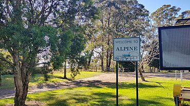
Alpine, New South Wales facts for kids
Quick facts for kids AlpineNew South Wales |
|||||||||||||||
|---|---|---|---|---|---|---|---|---|---|---|---|---|---|---|---|

Old Hume Highway, 2023
|
|||||||||||||||
| Postcode(s) | 2575 | ||||||||||||||
| Elevation | 615 m (2,018 ft) | ||||||||||||||
| Location |
|
||||||||||||||
| LGA(s) | Wingecarribee Shire | ||||||||||||||
| Region | Southern Highlands | ||||||||||||||
| County | Camden | ||||||||||||||
| Parish | Colo | ||||||||||||||
| State electorate(s) | Goulburn | ||||||||||||||
| Federal Division(s) |
|
||||||||||||||
|
|||||||||||||||
Alpine (/ˈælpiːn/) is a Northern Village of the Southern Highlands of New South Wales, Australia, in the Wingecarribee Shire. It is located north-east of Aylmerton and south of Yerrinbool. The Main Southern Line passes through the locality, and the Hume Highway runs along the western boundary. The Old South Road, an early precursor to the Hume Highway, runs through the centre of the locality, separating the rural western side from the Upper Nepean Catchment Area which is heavily forested.
Population
According to the 2021 census, the population of Alpine was 141. At the 2016 census, there were 54 living in Alpine.

All content from Kiddle encyclopedia articles (including the article images and facts) can be freely used under Attribution-ShareAlike license, unless stated otherwise. Cite this article:
Alpine, New South Wales Facts for Kids. Kiddle Encyclopedia.

