Aleutians West Census Area, Alaska facts for kids
Quick facts for kids
Aleutians West Census Area
|
|
|---|---|

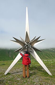
A World War II bunker abandoned in Dutch Harbor, Amaknak Island
|
|

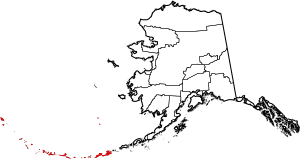
Location within the U.S. state of Alaska
|
|
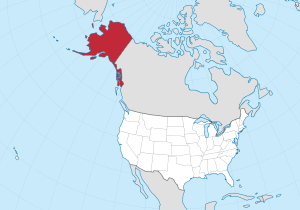
 Alaska's location within the U.S. |
|
| Country | |
| State | |
| Established | 1980 |
| Named for | Aleutian Islands |
| Largest city | Unalaska |
| Area | |
| • Total | 14,116 sq mi (36,560 km2) |
| • Land | 4,390 sq mi (11,400 km2) |
| • Water | 9,726 sq mi (25,190 km2) 68.9%% |
| Population
(2020)
|
|
| • Total | 5,122 |
| • Density | 1.27/sq mi (0.49/km2) |
| Time zones | UTC−9 (Alaska) |
| • Summer (DST) | UTC−8 (ADT) |
| UTC−10 (Hawaii–Aleutian) | |
| • Summer (DST) | HADT |
| Congressional district | At-large |

Aleutians West Census Area (Russian: Западные Алеутские острова) is a census area located in the U.S. state of Alaska. As of the 2020 census, the population was 5,232, down from 5,561 in 2010.
It is part of the Unorganized Borough and therefore has no borough seat. Its largest city is Unalaska, home to about 80% of the population. It contains most of the Aleutian Islands, from Attu Island in the west to Unalaska Island in the east, as well as the Pribilof Islands, which lie north of the Aleutians in the Bering Sea.
Contents
Geography
According to the U.S. Census Bureau, the census area has a total area of 14,116 square miles (36,560 km2), of which 4,390 square miles (11,400 km2) is land and 9,726 square miles (25,190 km2) (68.9%) is water. It borders the Aleutians East Borough to the east.
National protected areas
- Alaska Maritime National Wildlife Refuge (part of the Aleutian Islands and Bering Sea units)
- Aleutian Islands Wilderness (part)
- Bogoslof Wilderness
- Pribilof Islands
- Aleutian World War II National Historic Area
Cape
- Moss Point
Demographics
A 2014 analysis by The Atlantic found the Aleutians West Census Area to be the most racially diverse county-equivalent in the United States. According to the Brookings Institution, Asian Americans are the largest population of color in the census area, a majority of which are Filipino Americans.
2020 Census
| Race | Percentage of Population |
|---|---|
| White | 37.82% |
| Black or African American | 6.02% |
| American Indian or Alaska Native | 17.16% |
| Asian | 31.02% |
| Native Hawaiian and Other Pacific Islander | 5.39% |
| Some other race | 10.55% |
| Ancestry | Percentage of Population |
|---|---|
| Filipino | 39.68% |
| Aleut | 11.79% |
| Mexican | 8.62% |
| German | 5.71% |
| Black or African American | 4.63% |
| European | 4.08% |
| Irish | 3.98% |
| Vietnamese | 3.56% |
| Samoan | 2.65% |
| Cuban | 2.30% |
| Historical population | |||
|---|---|---|---|
| Census | Pop. | %± | |
| 1960 | 6,011 | — | |
| 1970 | 8,057 | 34.0% | |
| 1980 | 7,768 | −3.6% | |
| 1990 | 9,478 | 22.0% | |
| 2000 | 5,465 | −42.3% | |
| 2010 | 5,561 | 1.8% | |
| 2020 | 5,232 | −5.9% | |
| 2023 (est.) | 5,160 | −7.2% | |
| U.S. Decennial Census 1790-1960 1900-1990 1990-2000 2010-2020 |
|||
Communities
The largest community in the Aleutians West Census Area is the city of Unalaska.
Cities
Census-designated places
- Attu Station
- Nikolski
- Eareckson Station
Education
School districts within the census area are: Aleutian Region School District, Pribilof School District, and Unalaska City School District.
See also
 In Spanish: Área censal de Aleutianas Occidentales para niños

