Akron, Colorado facts for kids
Quick facts for kids
Akron, Colorado
|
|
|---|---|

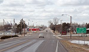
Entering Akron from the east (2013)
|
|

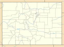
Location within Washington County and Colorado
|
|
| Country | |
| State | |
| County | Washington County seat |
| Incorporated | September 22, 1887 |
| Government | |
| • Type | Statutory Town |
| Area | |
| • Total | 2.77 sq mi (7.18 km2) |
| • Land | 2.77 sq mi (7.18 km2) |
| • Water | 0.00 sq mi (0.00 km2) |
| Elevation | 4,659 ft (1,420 m) |
| Population
(2020)
|
|
| • Total | 1,757 |
| • Density | 633.84/sq mi (244.70/km2) |
| Time zone | UTC−07:00 (MST) |
| • Summer (DST) | UTC−06:00 (MDT) |
| ZIP code |
80720
|
| Area code(s) | 970 |
| FIPS code | 08-00925 |
| GNIS ID | 182984 |
| Highways | US 34, SH 63 |
Akron is a Statutory Town that is the county seat and the most populous municipality of Washington County, Colorado, United States. The town population was 1,757 at the 2020 United States Census.
Contents
History
Akron was platted in 1882. Originally, Akron was a small camp on the railroad, being halfway between McCook and Denver. The community was named after Akron, Ohio, the native home of the wife of a railroad employee. The Akron, Colorado, post office opened on January 30, 1883, and the Town of Akron was incorporated on September 22, 1887.
Geography
Akron is located at the intersection of U.S. Highway 34 and State Highway 63 at coordinates 40°09′38″N 103°12′52″W / 40.1605°N 103.2144°W.
At the 2020 United States Census, the town had a total area of 1,774 acres (7.180 km2), all of it land.
Climate
Akron experiences a semi-arid climate (Köppen BSk) with cold, dry winters and hot, dry summers.
| Climate data for Akron, Colorado (Colorado Plains Regional Airport), 1991–2020 normals, extremes 1937–present | |||||||||||||
|---|---|---|---|---|---|---|---|---|---|---|---|---|---|
| Month | Jan | Feb | Mar | Apr | May | Jun | Jul | Aug | Sep | Oct | Nov | Dec | Year |
| Record high °F (°C) | 74 (23) |
78 (26) |
85 (29) |
91 (33) |
97 (36) |
107 (42) |
107 (42) |
109 (43) |
100 (38) |
91 (33) |
82 (28) |
80 (27) |
109 (43) |
| Mean maximum °F (°C) | 61.2 (16.2) |
65.5 (18.6) |
75.7 (24.3) |
82.2 (27.9) |
89.2 (31.8) |
96.9 (36.1) |
99.9 (37.7) |
97.6 (36.4) |
93.8 (34.3) |
84.8 (29.3) |
73.0 (22.8) |
62.3 (16.8) |
100.9 (38.3) |
| Mean daily maximum °F (°C) | 41.1 (5.1) |
43.5 (6.4) |
54.1 (12.3) |
60.9 (16.1) |
70.5 (21.4) |
82.5 (28.1) |
88.7 (31.5) |
86.5 (30.3) |
78.3 (25.7) |
63.8 (17.7) |
50.9 (10.5) |
41.1 (5.1) |
63.5 (17.5) |
| Daily mean °F (°C) | 29.1 (−1.6) |
31.3 (−0.4) |
40.5 (4.7) |
47.2 (8.4) |
56.9 (13.8) |
68.2 (20.1) |
74.5 (23.6) |
72.5 (22.5) |
64.1 (17.8) |
50.2 (10.1) |
38.3 (3.5) |
29.3 (−1.5) |
50.2 (10.1) |
| Mean daily minimum °F (°C) | 17.2 (−8.2) |
19.0 (−7.2) |
26.8 (−2.9) |
33.5 (0.8) |
43.4 (6.3) |
53.8 (12.1) |
60.3 (15.7) |
58.5 (14.7) |
49.9 (9.9) |
36.6 (2.6) |
25.8 (−3.4) |
17.5 (−8.1) |
36.9 (2.7) |
| Mean minimum °F (°C) | −3.8 (−19.9) |
−0.5 (−18.1) |
9.3 (−12.6) |
17.9 (−7.8) |
29.4 (−1.4) |
43.2 (6.2) |
51.7 (10.9) |
48.9 (9.4) |
35.9 (2.2) |
18.9 (−7.3) |
6.6 (−14.1) |
−2.9 (−19.4) |
−10.4 (−23.6) |
| Record low °F (°C) | −28 (−33) |
−29 (−34) |
−21 (−29) |
−3 (−19) |
19 (−7) |
28 (−2) |
38 (3) |
39 (4) |
17 (−8) |
0 (−18) |
−11 (−24) |
−25 (−32) |
−29 (−34) |
| Average precipitation inches (mm) | 0.17 (4.3) |
0.20 (5.1) |
0.71 (18) |
1.43 (36) |
2.65 (67) |
2.24 (57) |
2.78 (71) |
2.36 (60) |
1.24 (31) |
0.99 (25) |
0.42 (11) |
0.20 (5.1) |
15.39 (390.5) |
| Average snowfall inches (cm) | 5.6 (14) |
5.1 (13) |
8.6 (22) |
5.4 (14) |
0.4 (1.0) |
0.0 (0.0) |
0.0 (0.0) |
0.0 (0.0) |
0.9 (2.3) |
2.7 (6.9) |
7.8 (20) |
6.9 (18) |
43.4 (111.2) |
| Average precipitation days (≥ 0.01 in) | 3.2 | 3.4 | 5.4 | 8.6 | 10.7 | 9.6 | 10.4 | 9.2 | 6.2 | 6.0 | 4.1 | 2.8 | 79.6 |
| Average snowy days (≥ 0.1 in) | 3.9 | 4.1 | 4.9 | 2.7 | 0.3 | 0.0 | 0.0 | 0.0 | 0.5 | 1.7 | 4.4 | 4.1 | 26.6 |
| Source 1: National Weather Service | |||||||||||||
| Source 2: NOAA(average snowfall/snowy days 1981–2010) | |||||||||||||
Demographics
| Historical population | |||
|---|---|---|---|
| Census | Pop. | %± | |
| 1890 | 559 | — | |
| 1900 | 351 | −37.2% | |
| 1910 | 647 | 84.3% | |
| 1920 | 1,401 | 116.5% | |
| 1930 | 1,135 | −19.0% | |
| 1940 | 1,417 | 24.8% | |
| 1950 | 1,605 | 13.3% | |
| 1960 | 1,890 | 17.8% | |
| 1970 | 1,775 | −6.1% | |
| 1980 | 1,716 | −3.3% | |
| 1990 | 1,599 | −6.8% | |
| 2000 | 1,711 | 7.0% | |
| 2010 | 1,702 | −0.5% | |
| 2020 | 1,757 | 3.2% | |
| U.S. Decennial Census | |||
At the 2000 census there were 1,711 people in 734 households, including 457 families, in the town. The population density was 1,179.3 inhabitants per square mile (455.3/km2). There were 835 housing units at an average density of 575.5 per square mile (222.2/km2). The racial makeup of the town was 93.51% White, 0.12% African American, 1.23% Native American, 0.12% Asian, 0.06% Pacific Islander, 4.32% from other races, and 0.64% from two or more races. Hispanic or Latino of any race were 11.75%.
Of the 734 households 29.3% had children under the age of 18 living with them, 50.8% were married couples living together, 9.4% had a female householder with no spouse present, and 37.7% were non-families. 33.8% of households were one person and 16.8% were one person aged 65 or older. The average household size was 2.28 and the average family size was 2.94.
The age distribution was 26.2% under the age of 18, 6.3% from 18 to 24, 23.4% from 25 to 44, 21.0% from 45 to 64, and 23.1% 65 or older. The median age was 40 years. For every 100 females, there were 97.3 males. For every 100 females age 18 and over, there were 89.8 males.
The median household income was $29,420 and the median family income was $35,156. Males had a median income of $25,875 versus $21,000 for females. The per capita income for the town was $15,772. About 8.1% of families and 11.0% of the population were below the poverty line, including 13.9% of those under age 18 and 11.3% of those age 65 or over.
See also
 In Spanish: Akron (Colorado) para niños


