A2 road (England) facts for kids
Quick facts for kids
A2 road |
|
|---|---|

|
|
| Route information | |
| Length | 71.95 mi (115.79 km) |
| Major junctions | |
| North west end | Southwark 51°30′04″N 0°05′35″W / 51.5012°N 0.0931°W |
| South east end | Dover 51°07′35″N 1°19′38″E / 51.1263°N 1.3271°E |
| Location | |
| Primary destinations: |
Dartford, Rochester, Faversham, Canterbury |
| Road network | |
|
|
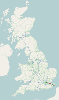
The A2 is an important road in South East England. It goes between London and Dover. In Dover, it connects to the port to France. The road follows tracks used by the Celts and the Romans over a thousand years ago. It once linked to the three main Roman ports: Rutupiae (now Richborough), Dubris (now Dover) and Portus Lemanis (in modern Lympne). It was given the name "A2" in the 1920s. Now, the road is about 72 miles (116 km) long.
Images for kids
-
A2 across Blackheath.
-
Looking west: the modern A2 crossing the River Medway at Rochester near the Roman and Celt crossings

All content from Kiddle encyclopedia articles (including the article images and facts) can be freely used under Attribution-ShareAlike license, unless stated otherwise. Cite this article:
A2 road (England) Facts for Kids. Kiddle Encyclopedia.


